
Export to High Resolution Image File
Voting Open
When exporting the map as an image file, it allows a maximum resolution of 10,000 pixels. (Screenshot added.) This resolution is not enough for a detailed map study. In comprehensive studies, the texts are not read when transferred as a picture. If this problem can be overcome without using a third-party software, it will ensure both the quality of the application and the usefulness of the prepared work files.
Therefore, if the export resolution can be increased to at least 20,000 pixels, a more efficient and readable image file will be created. It would be great if there could be an update on this in the future.
Files:
Resolution Prob...
 I like this idea
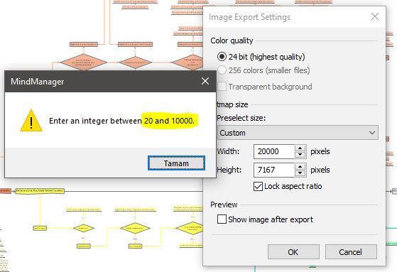
---